Sankalp Planners and Developers - Building Planner and Structural Consultant
Leading Building Planner, Designer Structural and Vaastu Consultant in Varanasi, Lucknow and Eastern UP
Open today until 6:00 PM
What is Surveying ?
Surveying is the process of using direct or indirect measurements to determine the relative positions of various features on, above, or beneath the earth’s surface, and then depicting them on a sheet of paper known as a plan or map.
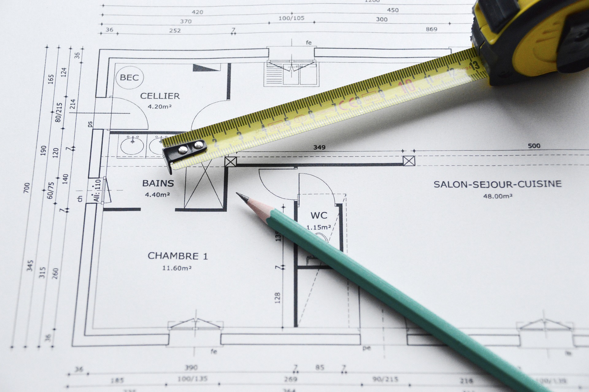
Building Surveying
It is critical for any property owner to be aware of the state of their investment.Building surveys are intended to give a thorough assessment and inspection in order to detect any potential hazards and enable owners to build remedial or maintenance plans.
Our building surveying teams are part of award-winning interdisciplinary firms that can offer a wide range of advice and services on all elements of property and construction within existing structures.
Importance of Surveying :-
Surveying is the process of creating a topographic map of the earth’s land surface. Surveying skills are useful in a variety of engineering processes. Any engineering project necessitates the use of surveying. Below are some of the most important aspects of surveying.
The first step in surveying is to draw out a plan and a portion of the region that will be surveyed. Based on the nature of the project, the best potential alignment, quantity of earthwork, and other relevant information can be computed using these prepared maps and sections.
Surveying measurements are used in the planning and design of all Civil Engineering projects, including railways, highways, tunneling, irrigation, dams, reservoirs, waterworks, sewage works, airfields, ports, enormous structures, and so on.
Any project of any size is built along the lines and points specified by surveying during its implementation.
Surveying is required for the measurement of land and the establishment of its borders. Without conducting survey work, the economic and engineering viability of a project cannot be effectively determined.
It is necessary to carry out hydrographic and oceanographic charting and mapping.
What Our Customers Say About Us
5/5
One of the best architects and structural consultants in the country. If you are in Varanasi / Lucknow or nearby, then definitely he is your man. His firm's projects are running in UP, Uttarakhand and MP
Nikhil S
5/5
Their work is fantastic..!!
Ishan P
5/5
Great designer and planner. Makes sure your projects are well planned and at least cost possible.